Transportation
A Map and links to the bus system and to taxis will appear soon.
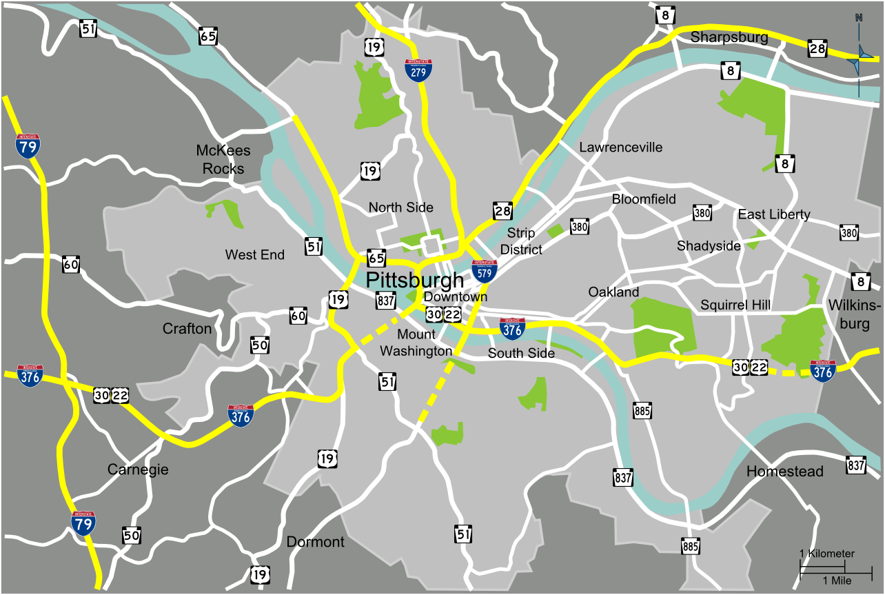
Map of the Greater-Pittsburgh area, showing the two destinations of the evening bus loop, South Side and North Side, as well as Downtown having many attractions, especially during business hours.
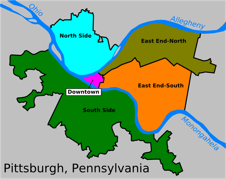
Downtown: The historic, economic, administrative, and cultural center of the city.
East End-South: The college neighborhood of Oakland; other neighborhoods: Shadyside and Squirrel Hill. Home to many institutions, parks, residential and shopping areas.
East End-North: A center of the city's ethnic diversity. Bustling with shops and restaurants. Neighborhoods: Strip District, Lawrenceville, Bloomfield, and East Liberty.
North Side: Sports teams and the city's finest museums are here. Neighborhoods: North Shore, Allegheny, and the Mexican War Streets.
South Side: A hilly region famous for its inclines and great views of the city as well as its bar scene. Neighborhoods: Southside Flats, Mt Washington, and some considered the "West End".
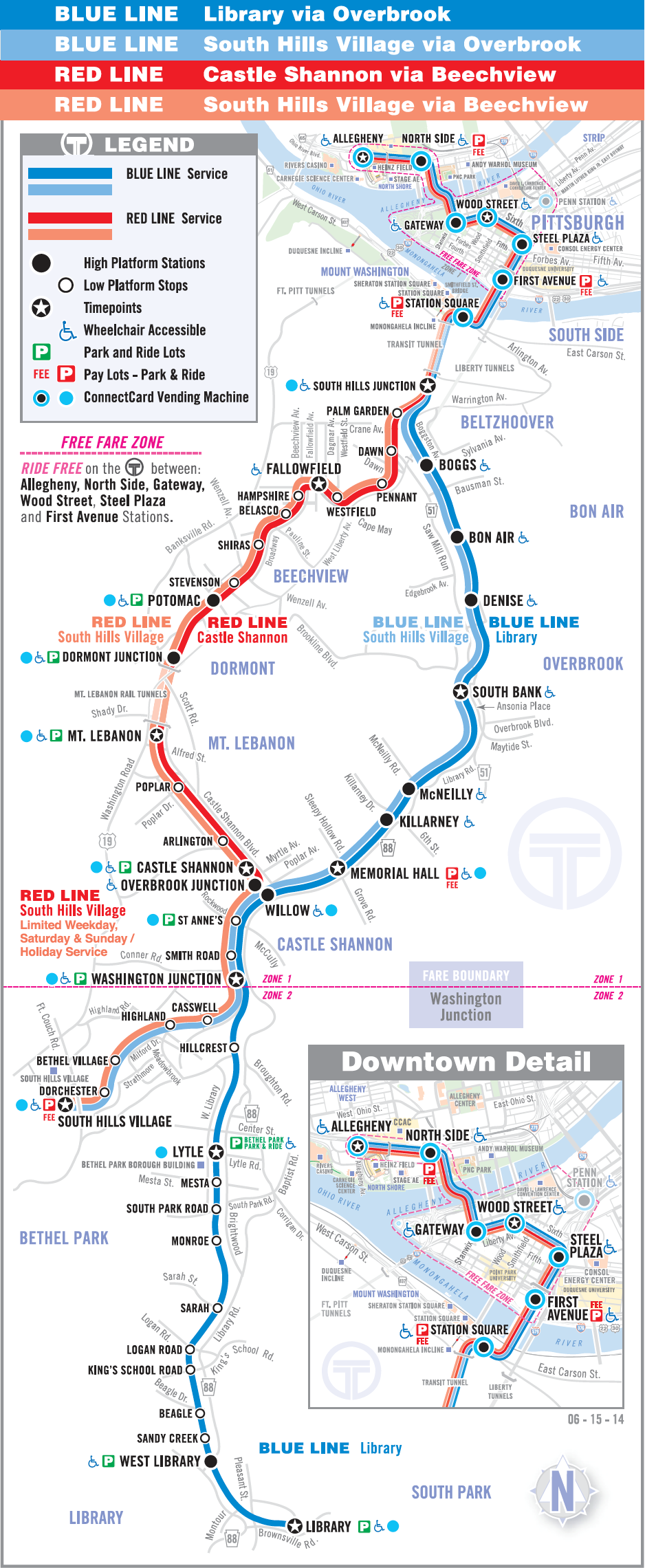
Pittsburgh Light Rail System Map (the subway)
The Pittsburgh Light Rail (commonly known as “The T”) is a 26.2-mile (42.2 km) light rail system in Pittsburgh, Pennsylvania. It functions as a subway in Downtown Pittsburgh and largely as an at-grade light rail service in the suburbs south of the city. The map is pasted, below.
The bus system map can be accessed at http://www.portauthority.org/paac/apps/maps/systemmap.pdf